

NASA: Earth Actually Looks Like A Potato
- 22.08.2026, 15:22
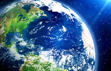
Its shape is far from a perfect sphere.
NASA scientists have unveiled an updated model of the Earth’s gravitational field, clearly demonstrating just how far our planet’s shape deviates from a perfect sphere. Based on many years of satellite observations, scientists have created a visualization in which every irregularity reflects the strength of Earth’s gravitational pull at a specific point on the globe, according to Euronews.
Gravity is distributed unevenly across the Earth’s surface—its strength is influenced by massive mountain ranges, deep ocean trenches, and variations in the density of rocks deep within the planet. To illustrate these differences, researchers use the geoid—a special mathematical model of Earth’s gravitational field. EuroNews draws attention to this.
Lumpy potato or just math? 🥔
The geoid is a mathematical model of Earth’s gravitational field, not what Earth actually looks like. Gravity is stronger where there’s more mass, so when those differences are scaled up by a factor of 10,000, the geoid gets lumpy. pic.twitter.com/6Z76seIkrE
— NASA Earth (@NASAEarth) August 11, 2026
Essentially, the geoid is a theoretical surface of the World Ocean, free from the influence of tides, waves, and wind, and formed solely by the force of gravity and the planet’s rotation. Where the mass of matter is greater, gravity pulls the water more strongly, creating notional elevations on the surface of the geoid. Conversely, where the mass is lower, the level of the notional ocean drops, forming a sort of depression.
In this visualization prepared by NASA, the elevation differences of the geoid are intentionally exaggerated by a factor of 10,000—this is done so that the gravitational relief is clearly visible to the human eye. In reality, however, the difference between the highest and lowest points of the model is only 191 meters.
The most pronounced elevation of the geoid is found near Iceland—there, its level exceeds the mathematical standard by 85 meters. And the deepest gravitational anomaly is located south of India: here, the conventional ocean surface drops 106 meters below normal.
The creation of such a detailed model was the result of a large-scale scientific effort spanning 15 years of continuous observations. Scientists processed over a billion measurements obtained from 19 satellites. Data from NASA’s “Gravity Recovery and Climate Experiment” (GRACE) mission, as well as from the European Space Agency’s “Gravity Field and Steady-State Ocean Circulation Explorer” (GOCE) satellite, played a particularly important role in this effort.
Today, scientists use the geoid to study the Earth’s gravitational field in detail and track how it changes as masses of water, ice, and other substances move across the planet. As NASA notes, this data is of strategic importance for modern cartography, topography, and high-precision navigation, helping to provide a deeper understanding of the global processes occurring on our planet.

Bank's name: Bank Millennium S.A.
Address: ul. Stanislawa Zaryna, 2A, 02-593, Warszawa
IBAN: PL97116022020000000216711123
SWIFT: BIGBPLPW
Name of the account holder: Fundacja “KARTA ‘97”
Purpose/title of payment: Donation for statuary aims
You can contact us by the e-mail charter97@gmail.com