

The UN Wants To Change The Familiar Map Of The World
62- 5.09.2026, 17:19
- 20,330

The only country that voted against the resolution was the United States.
The UN General Assembly supported an initiative by African countries to more accurately represent the sizes of the continents on world maps. This primarily involves moving away from the traditional Mercator projection, which has been in use for several centuries and significantly distorts the relative sizes of territories.
This was reported by NPR.
The Mercator projection was created by the Flemish cartographer Gerardus Mercator in 1569. It was well-suited for navigation, as it helped sailors chart their courses, but it has a significant drawback: the farther a territory is from the equator, the larger it appears on the map.
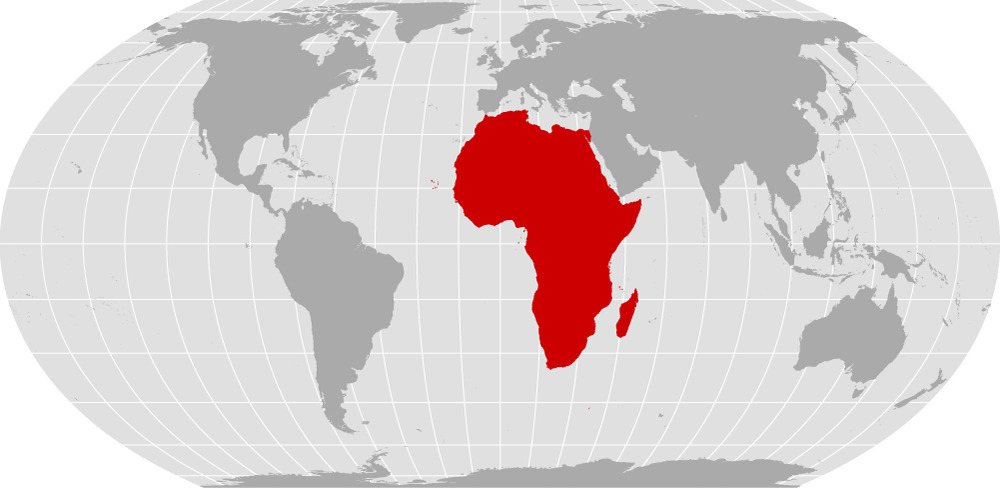
That’s why, on standard maps, Africa appears much smaller than it actually is. A comparison with Greenland is particularly telling: on a Mercator map, they may appear to be roughly the same size, even though Africa is about 14 times larger than Greenland.
This is precisely what formed the basis of the “Correct the Map” campaign, which Togo promoted on behalf of African countries. Its supporters insist that a map is not just a technical tool, but also a way of shaping people’s perception of the world.
What the UN Decided
On the eve of September 4, the UN General Assembly adopted the relevant resolution with 164 votes in favor. Six countries abstained, and the United States was the only country to vote against it.
The document calls for wider use of map projections that more accurately reflect the actual areas of the continents. One of the main options is Equal Earth—a projection created in 2018 specifically to maintain a more accurate ratio of territorial areas.
On such a map, Africa appears noticeably larger compared to Europe and Greenland, while territories near the poles, on the other hand, appear smaller.
Will the Mercator map disappear?
Not exactly. A UN General Assembly resolution is not legally binding, so it does not compel countries, schools, or technology companies to immediately abandon the Mercator projection. At the same time, supporters of the initiative hope that the UN resolution will encourage international organizations, publishers, educational institutions, and digital map developers to use more accurate projections.
Supporters of the campaign emphasize that the issue goes beyond cartography. In their view, the habitual visual shrinking of Africa over generations has influenced perceptions of the continent’s significance, its economic potential, and its place in global politics.
“A just world begins with a just map,” is how Togo’s Minister of Foreign Affairs Robert Dussi put it on the eve of the vote.
What Will Change for Ordinary Users
Most likely, the standard world map will not disappear from screens immediately. Any changes, if they occur, may gradually affect school atlases, textbooks, international organizations, the media, and digital mapping services.
In particular, the resolution calls on technology platforms to collaborate with governments and international organizations to implement more accurate projections. At the same time, services like Google Maps currently use a variant of the Mercator projection for their maps.
Thus, the UN resolution does not in itself redraw the world map, but it establishes an international framework for a gradual transition to a method of depicting the planet that more accurately reflects the actual sizes of the continents.

Bank's name: Bank Millennium S.A.
Address: ul. Stanislawa Zaryna, 2A, 02-593, Warszawa
IBAN: PL97116022020000000216711123
SWIFT: BIGBPLPW
Name of the account holder: Fundacja “KARTA ‘97”
Purpose/title of payment: Donation for statuary aims
You can contact us by the e-mail charter97@gmail.com